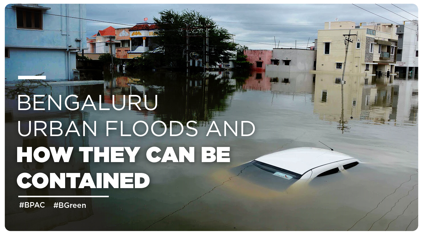
On 21st Nov 2021, Yelahanka received the highest rainfall of 153 mm followed by Horamavu in Mahadevapura zone (103 mm), Kannuru gram panchayat (143.5 mm). On 22nd Nov 2021, Yelahanka recorded 130 mm of rain which led to massive floods.
Many residential complexes and academic institutions were affected due to this. National Disaster Response Force (NDRF) and State Disaster Response Force (SDRF) had to be deployed to carry out relief and rescue operations. Stagnant water upto 4 feet had accumulated in Kendriya Vihar, Yelahanka which houses central government employees, forcing them to stay indoors. Water logging and flooding had also disrupted life at Jawaharlal Nehru Centre for Advanced Scientific Research (JNCASR).
Yelahanka zone is only one instance where flooding caused a major turmoil. In 2021, the India Meteorological Department (IMD) recorded 1,480.2 mm of rainfall in Bengaluru. In 2017, when the city had received the highest rainfall in 127 years, 1,696 mm rainfall was recorded.
In monsoons, floods in the urban areas of Bengaluru are a common occurrence, especially in the BBMP areas. When untimely and unexpected rainfalls, in 2021, brought life to a standstill in most parts of the city, it compelled the authorities to wake up and smell the coffee.
Urban floods can cause loss of life in addition to severe damages to public infrastructure and private properties. It’s a calamity that needs to be addressed. In a way, the floods provide additional water to the city and this can be channelised as a surplus resource. Many government and private organizations have taken up the cause to mitigate the damage and manage the flooding events. For example, the Indian Institute of Science (IISc), Bangalore, in association with Karnataka State Natural Disaster Monitoring Center (KSNDMC), Bangalore, has started a project titled, “Urban Flood Model for Bangalore”, funded by Department of Science and Technology (DST), Ministry of Science and Technology, Government of India under “Demand Driven Convergent Water Solutions in Mission Mode”.
B.PAC took it upon itself to get to the bottom of urban flooding problems in Bengaluru and find sustainable solutions to the same. On December 1ˢᵗ , 2021, a virtual panel discussion was conducted on the topic, Bengaluru Urban Flooding – Reading Under The Lines, with a few renowned environmental experts. Speakers S. Vishwanath, Biome Environmental Solutions, Naresh Narasimhan, VA Associates, Raj Bhagat, WRI, M N Thippeswamy, Retd CE, BWSSB, and Dr. Shubha Avinash, Water Resource Management Professional closely analysed the shortcomings, presented valuable observations and framed solutions.
Let’s look at the causes of floods in Bengaluru and the solutions that came to the fore from the panel discussion.
The Causes of Bengaluru Urban Floods
Bengaluru city was once a city of a 1000 lakes thanks to its topography, well-defined by valleys and ridges that caused the natural development of lakes in the entire area. The area was always prone to heavy rainfall, and in fact, the city was founded because of these lakes, as they stored rain water, which acted as sources of water to the nearby settlements. At present, there are four major valleys in Bengaluru, namely Vrishabhavathi valley, Koramangala valley, Challaghatta valley and Hebbal valley. According to Bruhat Bengaluru Mahanagara Palike or BBMP, there are 209 areas prone to flooding, all of them are located in these valleys. Out of the 209, 153 were sensitive and 53 were extremely sensitive. Earlier, in addition to forming lakes to store rain and flood water, these valleys also acted as a natural drainage system to let out excess water.
Present day Bengaluru has been highly urbanized which transpired quite rapidly in the recent years. Over the years, accelerating climate change and growing urbanization caused the lakes to deplete and dry up. These dried up open spaces in the valleys were then encroached upon and blocked by the construction of layouts, residential apartments, academic institutions and government buildings. Kendriya Vihar in Yelahanka which was inundated on 22nd nov 2021 is built on the Hebbal Valley. Additionally, different parts of the city experience rainfall in different intensities, which makes it all the more difficult to manage and channelise the surplus rainwater.
Raj Bhagat, Senior Programme Manager (geo-analytics) at World Resources Institute (WRI) India, explains, “It is imperative to understand the importance of valleys if we want to reduce flood damages in the cities. Unfortunately, construction is happening right in the middle of the valleys. The settlements, in the past, had been above the valleys and agricultural lands acted as a buffer. Due to urbanisation, agricultural lands were sold for residential or commercial establishments. Canals were rerouted post urbanisation. The present drains do not have the capacity to carry excess rainwater. Therefore the entire valley gets flooded.”
The B.PAC panel discussion – Bengaluru Urban Flooding – Reading Under The Lines – highlighted the following few key observations pertaining to the problem:

Solutions For Bengaluru Urban Floods
The expert panelists of the B.PAC Bengaluru Urban Flooding panel discussion recommended the most relevant solutions which have an infallible potential of eliminating the problem for improving the city infrastructure and alleviating the living standards of the citizens.

Improvising Bengaluru’s topography by keeping a check on encroachment in Storm Water Drainage system in valley areas, preventing deforestation, developing effective watershed management, restructuring sewer lines and redesigning open urban spaces are few of the many promising solutions which must be put into effect for a safer and flood resilient Bengaluru. Let’s look at the solutions more closely.
- The first and foremost is accountability at Government level. Organizations can chart an action plan to course correct the flaws pointed in AG’s report. Employing up-to-date technology for repairing the damage caused by torrential rains can be a part of the action plan. Different govt. departments can collectively work as a team to resolve this common issue.
On an average Bengaluru gets 62 days of rainfall every year (which went up to 82 days in the year 2021) in comparison to the Netherlands, a developed country, where it rains for 300 days a year. The example is proof enough that accountability and the will to get things done can solve civic issues.
- The master plans for building by-laws are greatly inadequate to understand and manage flood water. Complying with building by-laws which are built on a predictive model keeping in mind the future expansion of the city and predicting & preparing for the rainfall by teaming up with the meteorological department can go a long way.
- Open urban spaces can be redesigned in a way that the groundwater is not disturbed. Additionally, regular checking of the groundwater level can be mandated based on whether or not more water can permeate the ground. Siphons and sluez gates can be developed on the existing lakes in Bengaluru to channelise the floodwater.
- The Bangalore Water Supply and Sewerage Board (BWSSB) can restructure and manage the sewer network to accommodate the excess supply of flood water. The silt in the sewers can be cleaned on a regular basis to make space for the extra water to flow.
- Drainage system design in the city can be restructured in a manner that there is a connection with storm water drains and tertiary drains. Tertiary drains can be relocated to the edge of roads, one of the key areas prone to flooding. This water can be an asset which can be further utilised for irrigation and urban forestation. Desilting of drains can be regularised by BBMP.
- Enforcing land use plan as per a Master Plan which clearly delineates the short term and long term plans to manage the areas which tend to get flooded. Execution of the master plan can take place within the decided timelines.
- Complying to Roof Top water harvesting can reduce 40-50% flooding. The rainwater harvesting building by-laws demand that 60 mm of rain water should be harvested. These by-laws can be better adhered to by the authorities and citizens. Rainwater harvesting can be practiced on both micro and macro levels.
- Establishing spatial planning center for BMR (Bangalore Metropolitan Region) region which provides consolidated data related to accurate forecasting and aids in planning & execution of the urban flooding prevention model. The data collated can be made available to all participating stakeholders for a better execution of the plan.
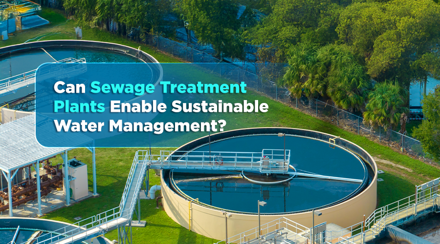
- A comprehensive micro and macro watershed management system can be worked upon to create small capacity sewage treatment plants to segregate solid waste from sewage and let only liquid waste enter the drains.
- Citizen engagement and support in planning and implementation can yield long lasting results.
To summarise, Bengaluru is not the only city in the world with urban flooding problems, but it’s topography is unique, and hence it requires a customised model of floodwater management. It can start with citizens collaborating with the agencies who can then lead the way with plausible plans to make changes in the infrastructure for long term impact.